Posted tagged ‘japan’

– I would go out tonight

July 17, 2016

What a beautiful Shimizu night to not go swimming. Actually, today was just a “Japan” day, in the best way. On the way to work, from the bus window, before 7am, I saw a man setting out his “Welcome fire 迎え火/mukaebi.” The welcome fires are to guide ancestors home when they come to visit in the midst of summer. The time when they they return to the human world and family is O-bon, and Bon festivals start at varying times around Japan, in either July or August. This is due to differences between the Gregorian and Lunar calendars. Shimizu follows the Gregorian.

The week before was Tanabata, which traditionally is on the seventh day of the seventh month (hence the name), but considering it’s literally the story of star-crossed lovers, the lunar calendar probably would be the more accurate guide for dates. Anyway, Tanabata ushers in Obon, and Shimizu has a pretty wicked Tanabata festival.See some photos at the end of the post.

Tonight, at the time I might have headed off to the pool if I could heave talked myself into it, I wandered out to the Tomoegawa (Tomoe River) Lantern Floating Festival. This is where “. . . paper lanterns are floated down a river, [as a] means to send off the sprits of the dead . . . on the last day of the Bon Festival.” So perhaps that man this morning was lighting his welcome fire for the last time? Or Miho area might operate on different times to Shimizu.

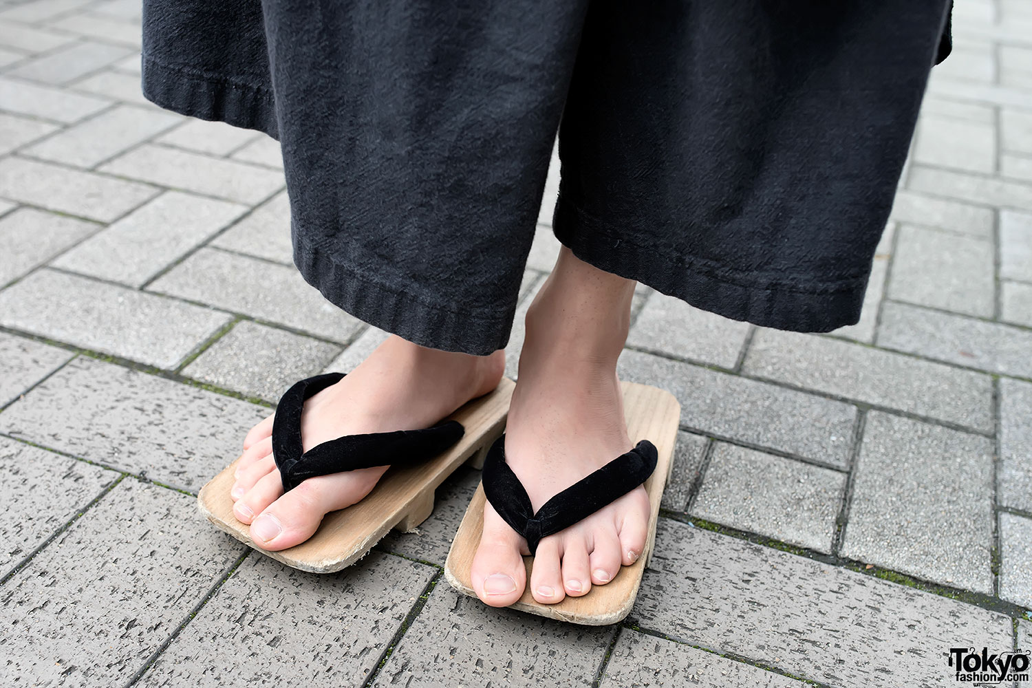
I was also on the way to the supermarket. The lazy drag of geta over the pavement (both male and female, and not super-traditional geta, I think), the casual comfort and beauty of the yukata and jinbei, and the excitement at wearing them, the little kids and families talking and laughing – their voices carrying over the river from the houses that rest directly on its banks, the furin tinkling away as if on traditional-Japanese-culture-cue, and the fish! the fish jumping like crazy all over and through the currents of the river and floating lanterns, were all a part of my stroll.

The street just before the river had an outdoor festival set up with yattai (food stalls), apparently a haunted house, some live music, and lots of people enjoying themselves (especially kids). Open that link in Google translate to get some idea of what was going on. I didn’t venture down the Ginza shopping district, as I’d pushed my way through the Tanabata decorations the week before, and I wanted to see what was going on at the river.

The Tomoegawa festival has a 250 year history, apparently, according to the link above and Google translate, though it was not held for about ten years during the Showa era, due to pollution of the river. Lanterns used to float out to sea (if they wound up in that direction), but they are now collected before that occurs. This year (and most years, I assume) there were five points where the lanterns were released. You can buy them, and write on them. I don’t know if you’d write your own name or an ancestor’s name. If it’s the family name, it’s probably one and the same. There were also the tezutsu hand-held fireworks, but I didn’t see those. The shot below is one I took of tezutsu in Toyohashi.

Tezutsu, Toyohashi, NOT Shiizu

Tezutsu, Toyohashi, NOT Shimizu

I walked to one of the bridges. The one in the photo below, I think, because the picture below that picture also features the kappa. He’s either at the other end of the bridge, or on the opposite side. The second picture is not mine.

Kappa_bridge

Kappa_Tomoegawa_Festival
Taken from this site.

However, it was nearing 8pm and the sun had set, so it was a lot darker than indicated above. Despite the days being warm and sticky, they’re getting shorter due to the solstice having passed. So, the river looked a whole lot more like the photo below, though it’s shot from further up the river, I think.

Today_Shimizu_Tomoegawa
This image taken from this post.

Again, I’m using Google translate, but the above link has some more interesting information on the festival.

The supermarket also had a festival-like feel. You should have seen the queue at the toilets, and families were buying whole watermelons.  Maybe for smashing open and sharing at the festival? Watermelon is a very festive-like fruit in Japan. Out of season, whole ones can be expensive, and there are traditional children’s games which incorporate the fruit. Summer comes in style here.

Though not much could be seen from the bridge by the supermarket, a few people still hung out, maybe waiting for lanterns to pass by. I crossed under the two railroad bridges nearby and followed the river to the area closer to the Shin-Shimizu station. People lined the river, though a lot more sporadically than in other places, to a background of drumming, taiko, in the distance. This is the stretch of river that has the beautiful plum blossoms in winter/spring. A lone lantern drifted along the current, trying to catch up with its brothers and sisters a little further downstream. A train passed across the bridge. I had no camera at hand this day, as you’ve probably already guessed. You need to lean over a barrier to see the river at this point. Some kids followed my example, surprised to see that I actually was looking at something they thought worth looking at, if only for a second 🙂

Fireworks started up, a fair way from this area, but still pretty. The traditional kind, not hand-held. I was walking away from them. The drumming stopped just about as soon as I got to the temple (and other side of the river) that they played across from. Kids and teenagers lit smaller fireworks down side streets. Local neighbourhood-watch-dudes in the blue uniforms of some kind of officialdom, and none a day under sixty, sat back and chatted – the surge of the crowds all but over.

My walk finally took me to one of the bridges about two kilometres from the river mouth. Here people also gathered, looking down at the water, wondering which lanterns would make it, saying goodbye to those already gone. Folks on boats and on the river’s edge fetched the lanterns, and blew out the candles if still lit.

The next big event is kappore and the minato matsuri, which is the big Shimizu fireworks’ festival.

kappore

Not my photo. Kappore. Taken from here.

These tanabata pics are mine though. We’re lucky in Shimizu – there’s usually a light breeze blowing in from the sea which helps diffuse the humidity. However, I think the local folk have the right idea. Take the party outside and enjoy yourself, and the humidity just becomes part of the general atmosphere––laidback and cheerful.

Shimizu_Tanabata_2016

IMG_1508

IMG_1517

IMG_1521

– encounter 13b – Utsunoya

February 17, 2016

All of our countries have routes that maybe our ancestors didn’t walk on, but which someone used. The indigenous population of Australia have lived on that land for at least 45,000 years. We have a land seeped in history. Only thing is, it isn’t ours. Different climates required different needs, and that which has been well-documented and has physical, tangible remains is maybe more accessible and familiar to the western imaginations, and perhaps provides many people with a touchstone to received and learnt, perhaps cellular, images of the past.

The paths that surround Utsunoya are linked to its history as being a town on the Old Tokaido road, and in fact, some of the original path can still be walked through the hills. To hike through those hills and visit the beautiful park nearby alone is worth it.That is, it’s cool to walk the path, but it would be cool to walk it without knowing it’s history too, though maybe not as cool.

What is suggested for exploration in the Utsunoya area by most websites seems to be a quick walk to Utsunoya from the road stop, if that’s where you disembarked from the bus. I walked up from Mariko basho. . . .

nearby_soba

A sign to a soba restaurant just over the bridge, and in Utsunoya. Hiking is always best rewarded with a lovely bowl of soba or udon.

on_the_right_way

This way to the Meiji Tunnel and other attractions.

tunnel sign

Keep going. A map at the entrance of Utsunoya.


Hiroshige

A replication of one of Hiroshige’s paintings, or in his style, of Utsunoya, or the Old Tokaido passing by it.

Utsunoya_street_1

Through the town itself.

Utsunoya_street_2

A few tourists were wandering around, but it was the later afternoon, wet and rainy. No tourists in this photo!

Utsunoya_street_3

Many things were shut up.

Utsunoya_street_4

It was still beautiful though. A dog barked at me constantly from the safety of his house. I couldn’t find the soba restaurant, but I didn’t look too far. I had a mountain to hike!

Utsunoya_stairs_01

The stairs up to the tunnel.

IUtsunoya_stairs_2

Keep climbing.

signs_3

Signs. Tunnel, tunnel, tunnel. If you look at the map way up above, there is more than one!

signs_4

Signs.

signs_5

Signs.

Old_Tokaido_Road_Sign

Signs to the old Tokaido Rd. I would be coming back to this, but was turning left for now.

Tunnel_Museum_Sign

Signs to the tunnel.

Utsunoya is picturesque, and a walk through the Meiji-era Utsunoya Pass tunnel, which was the first toll road in Japan is definitely worth it. There is nothing wrong with the traditional itinerary.

Utsunoya_Pass_Tunnel_1

Suruga side

Utsunoya_Pass_Tunnel_2

Suruga side

Utsunoya_Pass_Tunnel_3

Suruga side.

Utsunoya_Pass_Tunnel_5
Looking back at the Suruga side.

Utsunoya_Pass_Tunnel_6

On the way through.

Utsunoya_Pass_Tunnel_7

In the centre.

Utsunoya_Pass_Tunnel_8

Utsunoya Pass, Meiji era tunnel brickwork.

Utsunoya_Pass_Tunnel_9

Okabe side.

Utsunoya_Pass_Tunnel_plaque

Commemorating the importance of the tunnel, according to this site.

contraption

Again – are these machines used for transporting harvested tea?

Walking through the tunnel, you are departing areas contained within Shizuoka City (Suruga ward), and you exit into areas contained within Fujieda City (Okabe). The recommended itinerary might also tell you to, double back, and then walk up and over the hills along what is left of the Old Tokaido Road.

Old Tokaido Road Sign 2

Clearly marked on the right.

Old Tokaido Rd Sign 3

Less clearly marked, right where you need to turn, as is so often the case in Japan. Even so, I’m grateful for the signs in English when they are there.

Old Tokaido Rd stairs

Walking up to the Old Tokaido Rd.

Old Tokaido Rd jizo

Respects being paid to ancestors and gods,  on the corner overlooking Utsunoya.

Old Tokaido Rd village overview 1

An earlier photo showing how little the village below has changed.

Old Tokaido Rd village

Utsunoya.

Old Tokaido Rd bamboo

Bamboo brushing the curve of the road.

Old Tokaido Rd monument 2

Monument on Old Tokaido Rd, Utsunoya.

Old Tokaido Rd information

Information which I cannot read. It pertained to some foundation stones in the area.

Old Tokaido Rd foundation

These were foundations of maybe an inn. Below were the foundations of maybe a shrine, according to this site.

Old Tokaido Rd crest

Up and over the crest of the Old Tokaido Rd. Heading into the Fujieda shi side of thigs.

Old Tokaido Rd rise 1

And again.

Old Tokaido Rd tree roots 1

I thought that a storm must have blown through here recently. But photos on the Net from a number of years ago seem to indicate that this part of the path is always full of tree litter, and exposed roots.

Old Tokaido Rd tree roots 2

I can imagine monsoonal rain bringing these down in mudslides. They were beautiful, though. Magestic.

Old Tokaido Rd other side

Okabe side.

Old Tokaido Rd other side sign 1

Old Tokaido Rd sign on the Fujieda side of things.

Old Tokaido Rd other side sign 2

An entrance here, an entrance there.

Where you at?

There are a lot of maps around like this. If you can read a little kanji, it will help, but they can also give you a visual sense, even if you can’t.

Old Tokaido Rd other side sign 3

Old Tokaido Rd, Utsunoya, this way AND this way. You can see a haka (cemetery) in the background. That is a mikan (like a mandarin) tree just behind too. It was bearing fruit.

Old Tokaid Road tree roots 3

I retraced my steps. Many magnificent trees, though I don’t know how deeply their roots ran. I turned around to take this photo. I wasn’t walking in this direction.

Old Tokaido Rd stone marker

Stone marker.

Old Tokaido Rd information

Information.

Old Tokaido Rd Suruga side

Coming back to the Suruga side of the Old Tokaido Rd. It was beautiful walking through the hills with the rain tapping on the leaves, and birds singing. The rain was not too heavy, though I definitely needed my umbrella.

Old Tokaido Rd leading to tunnel stairs

If you could (you can’t) take those stairs, it would take you within proximity of the Utsunoya Pass Meiji tunnel.

Old Tokaido Rd Suruga side 2

I wandered once more to the Meiji Tunnel and walked through it.

What I would suggest you do however, rather than just the suggested itinerary, if you have the time, and your purpose is hiking, is to take the Tsuta no hosomichi from just behind the Utsunoya rest stop on the Shizuoka side. This website describes the path

This road is an oldest path for crossing the Utsunoya Pass, which is mentioned in “The Tale of Ise.”
It served as an important road until the old Tokaido was opened in 1590.
Many travelers walked along this path while it was used as an official road since the Heian period.

It is a tough trek though, and I walked past the entrance a few times towards the end of my hike, because I couldn’t actually believe it was the path. This blog post describes it as “incredibly steep.” “Hosoi” means narrow. A post that I can’t find at present says that it would take 25 minutes to climb and 15 minutes to descend. I’m actually terribly at climbing down mountains, and there were a lot of slippery looking rocks at the mouth of the path on the Okabe side, so reversing the route I’m suggesting above could be a good idea too (climb the really steep stuff, descend the more gentle – if there is a gentle descent. I suspect not).

Anyway, I’d pop over to Utsunoya village, do the section of the Tokaido trail which is there, and will also get your heart rate going if you don’t hike much, and even if you do, but it’s not too difficult. Double back, walk through the Meiji Tunnel, take the path that indicates the way to a museum.

map_overview-rest stop

map_overview_rest stop

This will exit at Tsuta-no-hosoimichi park. Turn left.

Once in the park, make sure you cross the bridges and enjoy the river and various structures controlling its flow (see below). The paths over the river lead back to the main trail, so you can enjoy this diversion. There is information around the park about the engineering, and also included slightly in blog post. From there I would continue, looking for the maps and signs for Tsuta no hosomichi and turn here (picture below). This is not my photo. I should have taken it. It’s from a guy who walked the Old Tokaido Rd on a wing and a prayer. The link to his blog is in the caption below the photo.

The entrance is across a small stream and begins with those rocks, or I guess it’s the river. I thought I had enough time to get back to the Utsunoya road stop, Suruga Ku side, but I wasn’t sure. It was about 4:30. The sun sets at 5:30, and though from the map it seemed I should be fine, it was wet, and getting darker, so I decided not to risk it. I was’t sure how long it would take. Photographs on the Internet indicate that I should have taken it though! If you google つたのほそみち入り口 you’ll get some hits. Definitely on my list.

The descent should take you to just behind the Utsunoya rest stop, Suruga side, the point that you started from. If you can get a hiking map from somewhere, there really are a lot of walks in the area, and they seem to loop up. If you can’t, give your self a good few hours (get there earlier, rather than later) and check out the many detailed maps as you go through. Some are bilingual, but not all are.

Bee Hives Utsunoya

Coming into Tsuta no Hosoimichi Park, I walked behind this house. It’s shed is full of bee hives (unused, I guess?? Or waiting to be used.)

Honey for sale Utsunoya

They were selling honey (hachimitsu はちみつ)

Suspension bridge Tsuta-no-hosoi michi park 01

These bridges were fun to cross, and with the gentle (or not so gentle) rain and mist, truly evocative.

Suspension bridge Tsuta-no-hosoi michi park

Another one.

Warrior Helmet Dam (Kiwada River Sabo Dam)

Damming this river was apparently an engineering feat. Actually, the building of all of the tunnels, and “harnessing” of nature, or complementing of nature (?) was. This dam is indicative of a larger dam further up the river (I think! It might be this one) called the Warrior Helmet Dam colloquially. It’s offical name is the Kiwada River Sabo Dam.

Bridge -Suspension bridge Tsuta-no-hosoi michi park

Bridge

Water wheel and other buildings Suspension bridge Tsuta-no-hosoi michi park

I don’t know if these smaller buildings operated as tea houses and so on when the weather was better and it was tourist season.

Buildings Suspension bridge Tsuta-no-hosoi mich park

Buildings, bridges, on the other side of the river.

Making of the dam

Information about the engineering was scattered around the park.

Map of the area Tsuta no hosoi michi park

Map of Tsuta no Hosoimichi Trail. I would have liked to have been armed with some of this information.

Explanation Tsuta-no-hosoi michi park 1

Information about Tsuta no Hosoimichi Park and Path. Click to enlarge.

Explanation Tsuta-no-hosoi michi park 2

Information about Tsuta no Hosoimichi Park and Path. Click to enlarge.

Explanation Tsuta-no-hosoi michi park 3

Information about Tsuta no Hosoimichi Park and Path. Apparently the path had been used officially since the Heian period, and was used prior to the opening of the Tokaido Rd. The Tokaido Rd. opened in 1590,as quoted above.

Looking back at the other side of the river Tsuta-no-hosoi michi park

There’s that little building, below, which I had passed directly on the other side of the river. I’m returning to the bus stop (or hoping to find it) now, after deciding I didn’t want to risk being stuck on a steep narrow path in the middle of the mountain ranges as the night fell.

Older house on the way to the Okabe side of Utsunoya rest stop

This older house was on the way to the Utsunoya road stop on the Okabe side (there are two).

Sign Tsuta no Hosoimichi Park

If you’re driving, this is the sign to look out for.

Clouds Okabe side of Utsunoya rest stop 1

I think I made the right decision. It was getting close to 5:00, and the clouds and mist were billowing in.

Clouds Okabe side of Utsunoya rest stop 2

Clouds, rain, traffic. I’m heading toward Fujieda here.

Clouds Okabe side of Utsunoya rest stop

Walking along on the wrong side of the road (for the bus), trying to figure out just how I was going to get home.

clouds Okabe side of Utsunoya rest stop

I crossed over a pedestrian walk way, a fair way down, when I saw a bus stop, and it was the right move. On this side, I could have caught a bus to Fujieda, and taken a train back. But it was preferable to get back to Shizuoka by bus from here. The rest stop can be seen in the distance on the right.

Detailed map Okabe side of Utsunoya rest stop 1

This was the map I really wanted! Lots of great detail in both languages. Click to enlarge. Exciting figuring things out with the resources at hand, though.

Detailed map Okabe side of Utsunoya rest stop

Information. Times. Click to enlarge.

Tsuta no Hosoi Michi explanation 1

Information. Yup, where I thought, You couldn’t possibly turn there, was exactly where you turned. Photos of the start of the Tsuta no Hosoimichi trail.

Tsuta no Hosoi Michi explanation 2

Information.

Clouds billowing in Utsunoya rest stop Okabe side 1

I found my bus stop. Actually, I walked to the next one, as I had about 20 minutes to wait, but stopped shy of walking through the working tunnel. Masses of cars, the tunnel is quite long, and I’m not sure if pedestrians were allowed.

Clouds billowing in Utsunoya rest stop Okabe side 2

Snake clouds. Trucks resting.

Clouds billowing in Utsunoya rest stop Okabe side 3

Mist and clouds.

Waiting for the bus Clouds billowing in Utsunoya rest stop Okabe side

The bus stop. Sakashita.

Arrival Clouds billowing in Utsunoya rest stop Okabe side

My bus! I was happy to see it. Lights always look pretty shining in the rain.

Aoi beer Golden Ale

A good day hiking was rewarded with a glass of Golden Ale once I returned to Shizuoka. Aoi is a local brewery and this little bar on one of the main streets has only about seven seats. Two were empty when I arrived. It was still early. Lots of individuals (well, 3 out of 5) were women enjoying a beer. Two, myself and the lady to my left, were solo.

Aoi Beer A taste of Green tea

According to my phone, I’d walked 65 flights of stairs. I hadn’t of course, but I’d gone up and down a fair number of gradients. This beer had traces of green tea flavour. I was having a chat to the master and another guy to my right by this time. I might have been onto my third bevvie. A mistake. Still, conversation wasn’t too bad, though my Japanese is pretty rusty nowadays.

Soba-cha

After leaving Aoi beer stand, I enjoyed a cup of soba-cha (buckwheat tea) at a soba restaurant at the station.

Oysters

I finally got my soba at the station. Not very romantic, I know, but very tasty. This was a small side dish of oysters. I ordered far too much.

Kani-soba

This soba contained shreds of crabmeat, and I can’t remember what the other flavours were. Delicious.

extras

It was a set, so tempura and rice too. Far too much, but I ate it all. 16 kilometres all up. Not bad for a half day trip with plenty of sightseeing and stops for photographs.

– quick

August 5, 2012

Trees rake branches across my hair.

(c)2012 theheartbeatsoftly/lizardrinking

Love the sway of the railway track,
Rain upon the carriage back.

(c)2012 theheartbeatsoftly/lizardrinking

– hanging in the hood

April 10, 2012

The old house behind the block of flats has a variety of trees that come into flower, gradually, through each season. This is the weeping sakura, hidden behind the other trees. What a beauty it is. It will be in full bloom in the next few days.

This one is from an early morning walk up to Mukaiyama park. I won’t show you pictures of the rubbish that was strewn from ohanami (cherry blossom viewing) the night before. Even so, at least people were in the park at night this year (out of respect to the victims of the tsunami/earthquake/reactor disaster, hanami only ran through the day last year, or the parties did), and the rubbish, though plentiful, was gathered near the bins.

theheartbeatsoftly/lizardrinking (c) 2012

– spring

March 21, 2012

Weeping plum blossoms at Mukaiyama Park

Weeping plum blossoms at Mukaiyama Park

theheartbeatsoftly/ lizardrinking (c) 2012

– tis the season

December 23, 2011

Though not his season, but “peace on earth” resonates all the same.

– amaryllis

June 18, 2011

– lines

May 15, 2011

– older Japanese photos

April 25, 2011

Snow jacket made from straw/twine. This was suspended from a beam in an old house that I visited during the Echigo Tsumari Art Triennial in 2009. This type of cape/jacket used to be common in that area.

Chiharu Shiota
【Japan】
House Memory
Year. 2009
Wool is spread and hung like spider webs and fills the void of the room. Old furniture and clothes collected from local residents is woven in. Thoughts and memories which have soaked into these things, slowly reappear.

Towada-Ko. Not sure if it’s in Aomori or Akita prefectures, or another. Yup, borders three prefectures – Aomori, Akita and Iwate.

– mukaiyama koen

April 18, 2011

– backyard

April 3, 2011

– Nobiru

March 24, 2011

where I stayed, and which I reference in this post and this one, was badly affected as seen by the photos in that link and below.

Photo by Max Hodges. Kindergarten, Nobiru, 2011

Photo by Max Hodges. Buddha image, 2nd floor, Nobiru Kindergarten, 2011

Very touching photos here too. Same photographer.

Photo by Max Hodges. Nobiru, 2011

Photo by Max Hodges. Nobiru, 2011.

The train station was relatively far from the shore. It took about fifteen minutes to walk there, yet it is ruined. The youth hostel was a whole lot closer. I’d be surprised if it survived. All it had going for it was that it was two-storeys, but that might not have been tall enough.

Photo by Max Hodges. Nobiru Train Station (?). 2011

Photo by Max Hodges. Nobiru Train Station. 2011.

The small place where I enjoyed the seafood ramen, and the towns on Miyatojima which were even closer to the ocean, if that is possible, might have survived depending upon which side of the peninsula they were on.

Damn.

– realisation

March 22, 2011

just now, I am only just realising that I travelled through a lot of the towns which have been laid to waste by the Tohoku earthquake and tsunami. I mean, I knew I’d gone through the area, but I didn’t realise how many of the deluged towns I had visited.

I travelled through both Fukushima and Miyagi prefectures in 2008 on the seishun juhachi kippu – a train ticket which gives you five days unlimited travel on local trains, for a limited period of time, all over Japan. The days do not have to be consecutive, which makes it a great deal.

It was originally introduced to induce students who had just finished high school and who were just entering university (hence the ju-hachi part – for those 18 years), those who had leisure, to see the country at a very leisurely pace. I wrote about my travels here.

I travelled from Nobiru, a town outside of Matsushima in an area called Oku-Matsushima down to Ishinomaki to take a bus to Ayukawa where I took a ferry to Kinkazan, a famous sacred island, and from my readings, just about where the epicentre of the Tohoku earthquake was, though my research is not thorough. Wikipedia says

The Oshika Peninsula is the closest part of Honshū to the epicenter of the 2011 Tōhoku Earthquake, with the island of Kinkasan to the east being only slightly closer. A report on March 14 indicated that 1,000 bodies had been found washed ashore on the peninsula.[1] The March 11 earthquake shifted Japan’s Oshika Peninsula near the epicenter by 5.3 metres (17 ft) and dropped it by 1.2 metres.

Some other trawling seems to indicate that tsunamis have been studied along that coast previously. I am trying to find a simple map, but all the simple maps won’t let me copy them.

Though I can find no news on Ayukawa, it does come under the Ishinomaki area, and I think of the people who ran the ferry and the small overgrown shrine area I went to while waiting for the bus back to the city. Earlier in the day, as I tried to book a ticket on the ferry to the island, I thought that I had lost my purse, and informed the operators. They in turn were going to inform the bus driver. The bus only runs 7 times a day, so location of my purse would not have been too bad. Before they did that, though, I found that I had left it just to the side of the bus stop while putting away all of my travel paraphernalia. A false alarm, and we were all pleased that I could board the ferry. The kindness and effort of the people who were going to go out of their way to help me, as many people do in Japan, stuck with me.

I was visiting slightly outside of tourist season. I couldn’t remember if I was too early, or too late, but the return ferry was the last for that day, departing at about 1.35 pm. I left at about 11.30 and only had a chance to spend ninety minutes or so on the island, and didn’t have a chance to explore the mountains, which have tracks, but are apparently famously wild with monkeys and tame deer (so they aren’t wild). I did get to see the deer, and the temple.

I stayed at Pila Youth hostel in Nobiru. It harbours one of the famous views of Japan’s 3 famous views (there are subsections). Okumatsushima is low-lying and very beautiful. Surrounded by white beaches and blue-green seas. Some blogs I have been reading state that Matsushima was spared, and so, maybe Oku-Matsushima was too, but the webpage for Pila Youth Hostel says that it is closed due to the effects of the tsunami. The beach at Nobiru – just opposite the hostel, has black sand and is popular, but I hired a bicycle and cycled Miyatojima (Miyato island) and admired the white-sand beaches such as Tsukihama, and Ohhama.

I met an American girl at Pila Youth Hostel, who was following my footsteps it seemed, a day after. She was going to stay on Kinkazan at one of the minshuku – a family run Japanese inn. I wish that I had decided to do that too. We went to a local restaurant I had found which served the most amazing seafood ramen, though I still don’t know if I’m really all that keen on crab’s brains. It certainly was fishy. Run by a couple; families, and old men enjoying a beer, ate there too, maybe about the only alternative in the area to cooking at home.

I can converse in Japanese. I am by no means fluent, but I can connect a little, and the people I met were down to earth, seaside folk. Ayukawa used to be a whaling port, and still has a whaling festival. Seeing how close Ayukawa and Kinkazan were to the epicentre, it seems that Ayukawa might have been right on the epicentre, I wonder what is left of those places. Ishinomaki, which was about an hour away at least by bus, was under water when water had receded from other towns, I wonder how they fared. Both have mountains, higher ground – maybe people were able to get there.

They were kind and the area is incredibly beautiful. The L.A. Times article linked to above, features a man who used a scuba suit*


Photo from Japan Probe, originally from L.A. Times?

to swim through the water to save his wife and mother. It classes him as unusual due to his manner and dress.

In a nation of careful dressers, Akaiwa sports Rambo-style army pants, a blue sweatshirt, muddy sneakers, legs wrapped in plastic secured with orange duct tape, and three different backpacks, including an L.L. Bean fanny pack with a tiny plastic anime character affixed, a doctor that saves people.

To go into battle, true, his outfit is a little unusual, though very practical, and I would say the muddy sneakers are inevitable. However, if you look at the weathered face in the photograph the Times runs with, it is the face of a thousand people who choose to live by the sea. It doesn’t state what his job is, but those in Nobiru and Ayukawa had similar everyday faces of outdoor wear and tear. The individualism that comes with not living in the city, and a contentment, it seemed, with who they were, and where they were from. Though I know that small towns can be restrictive as they are free in other ways.

Kinkazan is one of the three most sacred sites in Japan – Osorezan and Dewa Sanzan being the other two. All three have Buddhist temples or Shinto shrines, or both. Osorezan, way in the north-east of Honshu, Aomori Prefecture, was sacred to the local Ainu people before Shinto or Buddhism became popular. Dewa Sanzan is a pilgrimage site especially sacred to the “. . .mountain ascetic cult of Shugendo.” I have visted Kinkazan and Osorezan, and have long wanted to visit Dewa Sanzan.

Let’s hope that the residents of Ayukawa, Kinkazan and Ishinoseki have not made their way to the mystical lands of Osorezan, where souls in limbo reside. To disappear in such fear and panic must surely allow one to be reborn into a life far safer than the one left behind.

********************************************

NB, 26 March, 2010: This report here states that the town was destroyed due to its proximity to the epicentre. There is also a NYT article on the town. Three out of four homes were destroyed.

Photo taken from Japan Probe

The article concentrates on the whaling industry, or maybe its complete demise – no mention of Kinkazan – but it also features the resilience of the people, and the obvious hardships they are now going through and will continue to go through.

Nobiru was also devastated. I refer to that news in this post.

* Japan Probe corrects that to wet suit, which seems to make more sense. But read the comments – still a hero.

– untitled, march 18, 2011

March 20, 2011

I returned early
from the graduation party
where girls changed
from the clothes that
restricted the flow
of their beautiful
hakama to
easy-to-wear
up-to-date
dresses
which bubbled and fizzed
and folded
gently around them
as they did,
happy but
not unaware,
I didn’t blame them
for changing,
we all have to eat.
returned
to a hotel room
opposite the station
watching the news
of impending doom
or
not
my lover
our dog
buried in the crook
and curve
of his arm
or body
his warm heat and
giving body
unrelenting
in its loyalty and
acceptance
across the ocean,
and
I fell into bed
and asleep
as fire engines planned
to pour water
into reactors
close to fire and
people froze
in the snow
due to a dearth of
kindness
from mother nature
not from a lack of
kindness
from mother nature
which will see that most
as soon as, as soon as
will warm,
as soon as.

the sun was lifting even
as the last snows fell
and if the hearts of the people
could break the clouds
with what was needed,
people would complain
about the bruises caused
from falling cans of petrol and
soft blankets, and food
and from those who had not
been able to make
sense of
mother nature, swimming,
spinning through the air
towards them.
but their complaints would
be lost because
a bump on the head
is a small price to pay to
laugh about injuries with those
not fluent in the semaphore of disaster.
I never attended my graduation
never had the mortar board
the cape to
wear
always travelling
elsewhere
never attending
those important things.

theheartbeatsoftly (c) 2011

– another world away

January 2, 2011

seems strange that this was taken Feb 4, 2010, just under a year ago. All that snow, so constant and so much – then the rains, and soft spring and autumn days of Seattle, the winter and now summer of Australia. I think I have less idea of who I am now than I had back then, but life is change, and this unfamiliarity is not necessarily a bad thing. I don’t quite know who the woman who lived in that snow-laden land was either.